Downtown Newton Iowa

Get out of town

Day trips from Des Moines

11 nearby parks, towns and places to explore, ordered by straight-line distance.

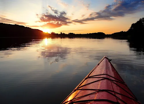
Lake Ahquabi State ParkState park

Lake Ahquabi State Park

21 miles south · straight-line distance

State park in Warren County, Iowa.

Confirm the visitor entrance, hours, reservations, access and seasonal conditions. Islands or water destinations may require different transport.
Town

Madrid

22 miles northwest · straight-line distanceAbout 35 min by car (30 road miles, typical traffic, checked October 2026)

City in Iowa, United States.

Confirm the visitor entrance, hours, reservations, access and seasonal conditions. Islands or water destinations may require different transport.
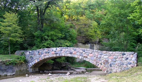
WintersetTown

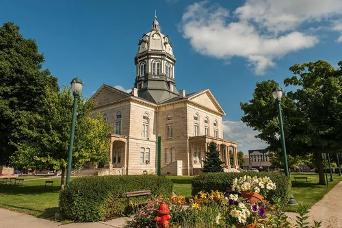
Winterset

27 miles southwest · straight-line distanceAbout 40 min by car (36 road miles, typical traffic, checked October 2026)

City and the county seat of Madison County, Iowa, United States.

Confirm the visitor entrance, hours, reservations, access and seasonal conditions. Islands or water destinations may require different transport.
Town

Ames

30 miles north · straight-line distanceAbout 35 min by car (36 road miles, typical traffic, checked October 2026)

City in Story County, Iowa, United States.

Confirm the visitor entrance, hours, reservations, access and seasonal conditions. Islands or water destinations may require different transport.
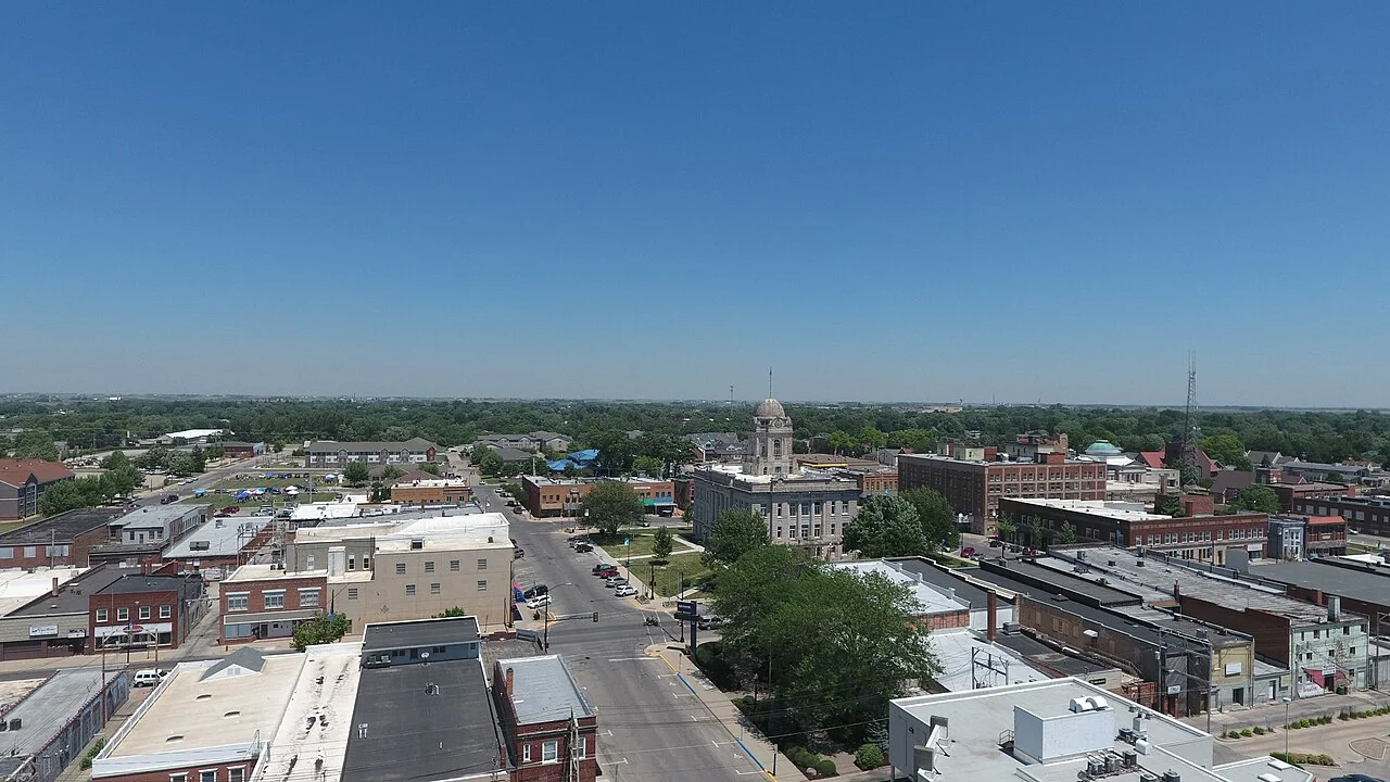
Downtown Newton IowaTown

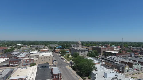
Newton

31 miles east · straight-line distanceAbout 35 min by car (36 road miles, typical traffic, checked October 2026)

City in and the county seat of Jasper County, Iowa, United States.

Confirm the visitor entrance, hours, reservations, access and seasonal conditions. Islands or water destinations may require different transport.

Town

Nevada

31 miles north · straight-line distanceAbout 35 min by car (38 road miles, typical traffic, checked October 2026)

City in and seat of Story County, Iowa, United States.

Confirm the visitor entrance, hours, reservations, access and seasonal conditions. Islands or water destinations may require different transport.

Ledges State ParkState park

Ledges State Park

31 miles northwest · straight-line distance

State park in Iowa, United States.

Confirm the visitor entrance, hours, reservations, access and seasonal conditions. Islands or water destinations may require different transport.

State park

Elk Rock State Park

31 miles southeast · straight-line distance

State park in Marion County, Iowa.

Confirm the visitor entrance, hours, reservations, access and seasonal conditions. Islands or water destinations may require different transport.

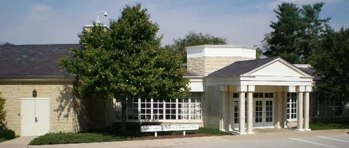
Herbert Hoover Presidential Library and MuseumThings to do

Herbert Hoover Presidential Library and Museum

118 miles east · straight-line distanceAbout 1 hr 50 min by car (123 road miles, typical traffic, checked October 2026)

Presidential library and museum for U.S. President Herbert Hoover in West Branch, Iowa.

Confirm the visitor entrance, hours, reservations, access and seasonal conditions. Islands or water destinations may require different transport.

Things to do

Omaha’s Henry Doorly Zoo and Aquarium

122 miles west · straight-line distanceAbout 2 hr by car (133 road miles, typical traffic, checked October 2026)

Zoo in the United States.

Confirm the visitor entrance, hours, reservations, access and seasonal conditions. Islands or water destinations may require different transport.

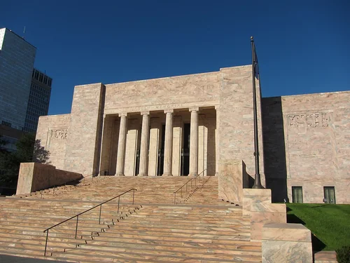
Joslyn Art MuseumThings to do

Joslyn Art Museum

122 miles west · straight-line distanceAbout 2 hr by car (135 road miles, typical traffic, checked October 2026)

Art museum in Omaha, Nebraska.

Confirm the visitor entrance, hours, reservations, access and seasonal conditions. Islands or water destinations may require different transport.

Driving times are typical estimates from the city center without live traffic, Powered by Geoapify · © OpenStreetMap contributors.

Distances are measured in a straight line from the city, not by road. Some older drive-time estimates have no reliable date and do not reflect current traffic; routes to large parks or waterfronts may vary. Check the destination entrance before leaving. Place descriptions come from Wikidata. Photo credits include capture dates when available; photos may not show current conditions.

Outdoor places near Des Moines

40 recreation areas and campgrounds within 134 miles, from Recreation.gov. Filter by what you want to do.

Campground

Bob Shetler Picnic Area

8 miles north · straight-line distanceAbout 25 min by car (12 road miles, checked October 2026)US Army Corps of Engineers

Bob Shetler Picnic Area is a day-use facility located in the tailwater area below Saylorville Dam, and is a popular destination for shoreline fishermen.

BikingCampingFishingHikingWildlife viewing

Campground

Cottonwood Recreation Area

8 miles north · straight-line distanceAbout 20 min by car (10 road miles, checked October 2026)US Army Corps of Engineers

Cottonwood Recreation Area is a day-use facility located in the tailwater area below Saylorville Dam. The 26,000-acre Saylorville Lake Project stretches over 50 miles up the Des Moines River Valley.

BikingCampingFishingHikingWildlife viewing

Campground

Bob Shetler Recreation Area

9 miles north · straight-line distanceAbout 20 min by car (12 road miles, checked October 2026)US Army Corps of Engineers

Bob Shetler Recreation Area is located in the tailwater area below the 26,000-acre Saylorville Lake Project, which stretches more than 50 miles up the Des Moines River Valley.

BikingBoatingCampingFishingHikingHuntingSwimmingWater sports

Recreation area

Saylorville Lake

9 miles north · straight-line distanceUS Army Corps of Engineers

The Saylorville Lake Project is 26,000 acres, which stretches for over 50 miles up the Des Moines River Valley.

BoatingCampingFishingHikingHorseback ridingNature educationPicnickingWater sports

Campground

Cherry Glen Campground

10 miles north · straight-line distanceAbout 20 min by car (12 road miles, checked October 2026)US Army Corps of Engineers

Cherry Glen Campground is located on the 26,000-acre Saylorville Lake Project, which stretches more than 50 miles up the Des Moines River Valley.

BikingBoatingCampingFishingHikingHuntingRanger programsSwimming

Campground

Cherry Glen Picnic

10 miles north · straight-line distanceAbout 20 min by car (12 road miles, checked October 2026)US Army Corps of Engineers

Cherry Glen Picnic Area is a day-use facility located on the 26,000-acre Saylorville Lake Project, which stretches over 50 miles up the Des Moines River Valley.

BikingCampingFishingHikingWildlife viewing

Campground

Oak Grove Picnic Area

11 miles north · straight-line distanceAbout 20 min by car (13 road miles, checked October 2026)US Army Corps of Engineers

Oak Grove Picnic Area is a day-use facility located on the 26,000-acre Saylorville Lake Project, which stretches over 50 miles up the Des Moines River Valley.

BikingCampingFishingHikingSwimmingWildlife viewing

Campground

Walnut Ridge Recreation Area

11 miles northwest · straight-line distanceAbout 25 min by car (13 road miles, checked October 2026)US Army Corps of Engineers

Walnut Ridge Recreation Area is a day-use facility located on the 26,000-acre Saylorville Lake Project, which stretches over 50 miles up the Des Moines River Valley.

BikingCampingFishingHikingWildlife viewing

Campground

Acorn Valley

12 miles northwest · straight-line distanceAbout 25 min by car (14 road miles, checked October 2026)US Army Corps of Engineers

Acorn Valley Campground is located on the 26,000-acre Saylorville Lake Project, which stretches over 50 miles up the Des Moines River Valley.

BikingBoatingCampingFishingHikingHuntingRanger programsSwimming

Campground

Prairie Flower Recreation Area

12 miles north · straight-line distanceAbout 20 min by car (14 road miles, checked October 2026)US Army Corps of Engineers

Prairie Flower Recreation Area is located on the 26,000-acre Saylorville Lake Project, which stretches more than 50 miles up the Des Moines River Valley.

BikingBoatingCampingFishingHikingHuntingSwimmingWater sports

Campground

Sandpiper Recreation Area

12 miles north · straight-line distanceAbout 25 min by car (15 road miles, checked October 2026)US Army Corps of Engineers

Sandpiper Recreation Area is a day-use facility located on the 26,000-acre Saylorville Lake Project, which stretches over 50 miles up the Des Moines River Valley.

BikingCampingFishingHikingWildlife viewing

Recreation area

Neal Smith National Wildlife Refuge

18 miles east · straight-line distanceFish and Wildlife Service

Neal Smith National Wildlife Refuge was established in 1990 with the mission to actively protect, restore, reconstruct and manage the diverse native ecosystems of tallgrass prairie, oak savanna and sedge meadow.

BikingBirdingCross Country SkiingEducational ProgramsFishingHikingHuntingPhotography

Campground

Elk Rock Campground and Boat Ramp

31 miles southeast · straight-line distanceAbout 50 min by car (40 road miles, checked October 2026)US Army Corps of Engineers

This recreation area is part of Lake Red Rock

BoatingCampingHorseback ridingWater sports

Campground

Roberts Creek East Campground

32 miles east · straight-line distanceAbout 45 min by car (40 road miles, checked October 2026)US Army Corps of Engineers

This recreation area is part of Lake Red Rock

CampingHikingPicnicking

Campground

Roberts Creek West Campground

32 miles east · straight-line distanceAbout 45 min by car (40 road miles, checked October 2026)US Army Corps of Engineers

This recreation area is part of Lake Red Rock

Camping

Campground

Fifield (Ia)

33 miles east · straight-line distanceAbout 50 min by car (41 road miles, checked October 2026)US Army Corps of Engineers

Fifield is located on Lake Red Rock, Iowa's largest lake. It is just 10 miles from Pella, known for its Dutch heritage, and 15 miles from Knoxville, the Sprint car capital of the world.

BikingBirdingCampingPicnickingWildlife viewing

Campground

Whitebreast Point Shelter (Ia)

33 miles southeast · straight-line distanceAbout 1 hr 5 min by car (53 road miles, checked October 2026)US Army Corps of Engineers

Whitebreast Point Shelter is a day use facility located within Whitebreast Campground. The shelter is located on Lake Red Rock, Iowa's largest lake.

BirdingBoatingCampingFishingWildlife viewing

Campground

Miner'S Retreat Enclosed Shelter (Ia)

34 miles southeast · straight-line distanceAbout 1 hr by car (52 road miles, checked October 2026)US Army Corps of Engineers

Miner's Retreat Enclosed Shelter is located on Lake Red Rock, Iowa's largest lake. It is just 10 minutes from Pella, known for its Dutch heritage, and 15 minutes from Knoxville, the Sprint car capital of the world.

BirdingCampingHikingPicnickingSwimmingWater AccessWildlife viewing

Campground

Wallashuck

35 miles east · straight-line distanceAbout 50 min by car (42 road miles, checked October 2026)US Army Corps of Engineers

Wallashuck Campground is located on Lake Red Rock, Iowa’s largest lake. It is just 10 minutes from Pella, known for its Dutch heritage, and 15 minutes from Knoxville, the Sprint car capital of the world.

BikingBoatingCampingFishingHiking

Campground

Whitebreast Camp

35 miles southeast · straight-line distanceAbout 1 hr by car (51 road miles, checked October 2026)US Army Corps of Engineers

Whitebreast Camp is located on Lake Red Rock, Iowa's largest lake. It is just 10 minutes from Pella, known for its Dutch heritage, and 15 minutes from Knoxville, the Sprint car capital of the world.

BikingBoatingCampingFishingHikingSwimmingWildlife viewing

Campground

North Overlook Picnic Shelter (Ia)

36 miles southeast · straight-line distanceAbout 50 min by car (46 road miles, checked October 2026)US Army Corps of Engineers

North Overlook Picnic Shelter is located adjacent from North Overlook Campground on Lake Red Rock, Iowa's largest lake.

BikingBirdingCampingHikingMountain BikingPicnickingWildlife viewing

Campground

South Overlook (Ia)

36 miles southeast · straight-line distanceAbout 50 min by car (47 road miles, checked October 2026)US Army Corps of Engineers

South Overlook is located on Lake Red Rock, Iowa's largest lake. It is just 10 miles from Pella, known for its Dutch heritage, and 15 miles from Knoxville, the Sprint car capital of the world.

BikingBoatingCampingHuntingWildlife viewing

Campground

Howell Station

37 miles southeast · straight-line distanceAbout 55 min by car (47 road miles, checked October 2026)US Army Corps of Engineers

Howell Station Campground sits just below the Red Rock Dam and Lake on the north side of the Des Moines River.

BikingBoatingCampingFishingHikingWildlife viewing

Recreation area

Lake Red Rock

37 miles southeast · straight-line distanceUS Army Corps of Engineers

Lake Red Rock is Iowa's largest lake and is just 10 minutes from Pella, known for its Dutch heritage and 15 minutes from Knoxville, Sprintcar Capital of the World.

BikingBoatingCampingFishingHikingHorseback ridingHotel/Lodge/Resort Privately OwnedNature education

Campground

North Overlook Camp

37 miles southeast · straight-line distanceAbout 50 min by car (45 road miles, checked October 2026)US Army Corps of Engineers

North Overlook Campground is located on Lake Red Rock, Iowa's largest lake. It is just 10 minutes from Pella, known for its Dutch heritage, and 15 minutes from Knoxville, the Sprint car capital of the world.

BikingBoatingCampingFishingHikingSwimming

Campground

Bridgeview (Rathbun Lake)

58 miles southeast · straight-line distanceAbout 1 hr 45 min by car (77 road miles, checked October 2026)US Army Corps of Engineers

Bridgeview Park is located on beautiful Rathbun Lake, just 13 miles northwest of Centerville, Iowa. Camping, boating, swimming, fishing and picnicking are popular activities at this waterfront recreation area.

BikingBoatingCampingCanoeingFishingHikingIce ClimbingInformation Site

Campground

Prairie Ridge (Rathbun Lake)

62 miles southeast · straight-line distanceAbout 1 hr 40 min by car (80 road miles, checked October 2026)US Army Corps of Engineers

Prairie Ridge Park is located 6 miles, SW of the Jct of Iowa Highway 5 and J18 at Moravia. Awesome Sunsets- No Extra Charge! Rathbun's off-the-beaten path park offers unique opportunities for lover's of the outdoors.

BikingBoatingCampingCanoeingFishingHikingKayakingPicnicking

Recreation area

Rathbun Lake

65 miles southeast · straight-line distanceUS Army Corps of Engineers

Over 700 campsites are available at this 11,000-acre lake in the rolling hills of southern Iowa. Excellent camping, fishing, hunting, boating, state fish hatchery, and Honey Creek Resort, are major attractions.

BikingBoatingCampingFishingHikingHistoryHotel/Lodge/Resort Privately OwnedNature education

Recreation area

Coralville Lake

109 miles east · straight-line distanceUS Army Corps of Engineers

Coralville Lake is a multiple use project providing primary benefits in flood control and low flow augmentation, and secondary benefits in recreation, fish and wildlife management, forest management and water quality improvement.

BikingBoatingCampingFishingHikingHistoryNature educationOff-highway vehicles

Recreation area

Herbert Hoover National Historic Site

118 miles east · straight-line distanceNational Park Service

Orphaned at age nine, Herbert Hoover left West Branch never to live here again. In later years, he returned to his humble birthplace to celebrate his long career of public service.

HikingHistoryPicnickingWildlife viewing

Recreation area

Iowa Wetland Management District

120 miles north · straight-line distanceFish and Wildlife Service

Iowa Wetland Management District includes 75 waterfowl production areas encompassing more than 25,000 acres scattered throughout 18 counties in north-central Iowa.

BirdingCross Country SkiingFishingHikingHuntingMotor BoatNon-Motorized BoatingPhotography

Recreation area

Union Slough National Wildlife Refuge

120 miles north · straight-line distanceFish and Wildlife Service

Located in north-central Iowa in the southeast corner of the Prairie Pothole Region, Union Slough is all that remains of a pre-glacial riverbed.

BirdingCross Country SkiingFishingHikingHuntingMotor BoatNon-Motorized BoatingPhotography

Recreation area

Boyer Chute National Wildlife Refuge

121 miles west · straight-line distanceFish and Wildlife Service

Boyer Chute National Wildlife Refuge was established to recover fish and wildlife habitat in and along the Missouri River and to restore essential wildlife habitat that became scarce after the river was "improved" for navigation half a…

ArcheryBikingBirdingCross Country SkiingEducational ProgramsFishingHikingHunting

Recreation area

DeSoto National Wildlife Refuge

124 miles west · straight-line distanceFish and Wildlife Service

DeSoto National Wildlife Refuge was established in March of 1958 with the approval of the Migratory Bird Conservation Commission with the dual intention of providing for the needs of migratory birds and providing public recreation to local…

ArcheryBikingBirdingBoatingEducational ProgramsFishingHikingHistory

Recreation area

Glenn Cunningham Lake

127 miles west · straight-line distanceUS Army Corps of Engineers

Visitors here enjoy picnicking, no-wake boating, hiking, biking, nature trails, birding, disc golf, archery, and fishing. Horseback riding is also permitted in designated areas.

Nature educationWildlife viewing

Recreation area

Standing Bear Lake

131 miles west · straight-line distanceUS Army Corps of Engineers

Standing Bear Lake, NE, located in northwest Omaha, is named for the Ponca leader Chief Standing Bear, and is operated by the City of Omaha.

Wildlife viewing

Recreation area

Port Louisa National Wildlife Refuge

132 miles east · straight-line distanceFish and Wildlife Service

The 24,149 acre Port Louisa National Wildlife Refuge was established for the protection of migratory birds and other wildlife. Although the U.S.

ArcheryBackpackingBikingBirdingBoatingFishingHikingHunting

Recreation area

Loess Bluffs National Wildlife Refuge

134 miles southwest · straight-line distanceFish and Wildlife Service

Loess Bluffs National Wildlife Refuge is located in northwest Missouri, near Mound City.

BikingBirdingFishingHikingHuntingPhotographyPicnickingRanger programs

Recreation area

Wehrspann Lake

134 miles west · straight-line distanceUS Army Corps of Engineers

Wehrspann Lake, NE, located in southwest Omaha is, operated by the Papio-Missouri River Natural Resource District (NRD).

Nature educationWildlife viewing

Recreation area

Zorinsky Lake

134 miles west · straight-line distanceUS Army Corps of Engineers

Zorinsky Lake, NE, located in west Omaha, was named after the late U.S. Senator Edward Zorinsky.

BikingBoatingCampingFishingHikingHorseback ridingNature educationPicnicking

Recreation areas and campgrounds from Recreation.gov's directory, checked October 9, 2026. Listings are not live availability: check Recreation.gov or the managing agency for open dates, fees, reservations and conditions. Directions go to the listed coordinates, which may not be the entrance. Campground driving times: Powered by Geoapify · © OpenStreetMap contributors.

Questions

What day-trip ideas are near Des Moines?

This guide includes Lake Ahquabi State Park, Madrid, Winterset, Ames, Newton. Places are ordered by straight-line distance. Confirm visitor access, opening hours and current travel conditions before choosing a trip.

How far is Lake Ahquabi State Park from Des Moines?

Approximately 21 miles south in a straight line. This is not current traffic or a route to a confirmed visitor entrance. Check your route before leaving.

How far is Madrid from Des Moines?

Approximately 22 miles northwest in a straight line; driving takes about 35 min over 30 road miles in typical traffic (Geoapify, checked October 2026). This is not current traffic or a route to a confirmed visitor entrance. Check your route before leaving.

How far is Winterset from Des Moines?

Approximately 27 miles southwest in a straight line; driving takes about 40 min over 36 road miles in typical traffic (Geoapify, checked October 2026). This is not current traffic or a route to a confirmed visitor entrance. Check your route before leaving.

Where can I camp near Des Moines?

Recreation.gov lists 24 campgrounds within 62 miles, including Bob Shetler Picnic Area (8 miles north), Cottonwood Recreation Area (8 miles north), Bob Shetler Recreation Area (9 miles north). Check Recreation.gov for current availability, seasons and reservations.

Des Moines AI

Your Des Moines local guide
Hey there!

I'm Des Moines AI. Ask about neighborhood food, independent shops, local history or planning a visit.

AI recommendations may be inaccurate. Verify hours and prices. Questions are processed by Cloudflare. Privacy